Stop and Go, Stop and Go
Wednesday's schedule was an exercise in patience. Our first-thing-in-the-morning meeting with
officials of the municipality of Palo had been canceled without anyone knowing.
When we arrived at City Hall, we were informed that Council had decided that
more members needed to be in attendance for the meeting, so we were asked to return
the following Tuesday (our last full day here). We then headed to the Kusog
Tacloban office, it was locked, so we then set off to find a place with
Internet and to work on the computer, typing up notes and posting blog entries.
Three attempts later and a trip across town, we settled at a hotel lounge in Downtown Tacloban. After
lunch, we headed back to the Kusog Tacloban office. To summarize, the day
involved a lot of driving and waiting and figuring out where to go next, and,
later in the day, attempting to prop ourselves up at a group dinner, as the
jet-lag nagged at us. This short snippet is included to give you a flavor of
the frustrations that may crop up in the course of a day when you have not
quite become accustomed to the daily rhythm of life, when you are used to being
in more control of your schedule—and your circadian rhythm! Thus, the virtue of
patience should remain forefront in the visiting volunteer’s mind, the key to
staying buoyant and finding satisfaction in the small successes of the day.
Stories from Yolanda
There are
times each day when stories from Yolanda well up. At lunch on Tuesday, a guy
sitting next to us piped up and asked if we were American. He was too, though
Philippine-born and recently moved back after a lifetime in the States and a
career in the Service. He and his wife had settled in Barugo (a town in Leyte, which
we will visit on Monday the 8th) and taken up coconut farming. They
lost their trees during Yolanda and took haven for a while in Manila. They are
currently there for work, though the plan is to settle back down here.
 |
Dinner at Don Julio's with some of the Kusog crew:
starting front-left going clockwise, Dennis Delgado,
Magina
Fernandez, Joji Dorado, yours truly,
Marie, Angie Lopez, and Lito Mendonez
(poor Lito got cut off in the photo)
|
On Thursday,
we attended a dinner at the home of the Garile family that owns
Tacloban’s leading newspaper. The Leyte Samar Daily Express. They are family friends
of our host Dennis Delgado (Kusog volunteer). Mr. and Mrs. Garile shared the
frightful account of their survival during Yolanda. The storm surge swept
through their neighborhood on the north side of town, quickly flooding their
one-story home and forcing them up onto the roof, where they bunkered behind a
water storage tank, crouching. Everyone survived, though Mr. tore several
tendons in his leg during the escape to the roof. Several neighbors perished.
The family’s business was affected; the storm surge flooded their downtown
printing operation, destroying the equipment that produced the daily newspaper.
They are now printing once-a-week via a facility in the capital Manila.
 |
On our
Thursday visit to Tanauan, we drove out to Barangay Pago to check out new resettlement
homes for coastal residents. These are townhouses about 1.5 kilometeres or so from the
coast. An older woman sitting under a covered area for vendors asked me sit
with her. She told me of her husband, age 68, who was “hard-headed” and would
not leave their home during the evacuation. He perished, and now she will leave
their home by the sea permanently, once her unit at the Pago complex is
finished.
Tanauan, First to Have a Plan
 |
| The resettlement community in Pago, Tanauan, Leyte. |
We
met with the mayor to discuss the project with Kusog Tacloban. He kindly
listened to our brief presentation, but told us that “data gathering” had taken
a backseat for now, because implementing the rehabilitation plan swiftly and
effectively through concrete projects was most crucial. The city got its
rehabilitation rolling in December, and has thus far completed sheltering for 47
of 54 barangays and started many of the projects described above. Having not
read the recovery plan, we asked the mayor to update us on rehabilitation in
Tanauan. He eagerly showed us to the lobby of the municipal building where gleaming
posters with maps and architectural renderings summarized projects in the areas
of sheltering, livelihoods, and infrastructure. We learned that all residents
within 50 meters of the coast will be relocated and that the area has been
rezoned for commercial activity. Resettlement areas, such as the one in Pago, will
be placed within reasonable commuting distance of seaside livelihoods.
Fortunately, Tanauan had worked with GIZ on a SIMPLE-based participatory
planning process to develop its latest ten year comprehensive land use plan
(CLUP) (a copy of which we saw at the GIZ office); this had been updated in
October before the storm and should provide a basis for sound land use
decision-making.
 |
One of a dozen or so posters at the municipal building
detailing Tanauan's rehabilitation plan.
|
In
Philippine municipalities, the mayor is the chief executive, and the vice mayor
is the head of council. Just as soon as the mayor was through with his
presentation, he was whisked away to another meeting, and we were hurried
upstairs to meet the vice mayor and council. After a quick and condensed review
with the mayor of his vision for Tanaun, we had a more measured discussion with
Vice Mayor Roland Flores and three councilors (council members) about our ideas
and their needs.
Our tools
were met with critique. The sections suggesting ideal situation of development
relative to risks that would be much too rigid to follow on the ground
said the vice mayor, and the councilwoman in charge of the housing and social
services committee told us that the questionnaires we had prepared (we had
since changed the format from a scorecard to a simple checklist) were too
“intellectual” and needed to be more grounded in/directly linked to residents’
needs as far as shelter and livelihood—particularly now, in wake of Yolanda. And
since one round of barangay-level participatory and thematic mapping had been
completed and incorporated into the municipality’s CLUP, what was really needed
now was localized scientific data, more finely detailed data and mapping of
risks to be used in future updates of the CLUP—this over additional input from
local residents. Of course, we cannot provide that sort of data (we too wish
that they existed and were available), so we tried to redirect the conversation
towards our involvement with Kusog Tacloban and how education and awareness
among residents could serve the greater community.
The
president of the barangay captains’ association, Ina Larrazabal-Gimenez, arrived
during the meeting. She emphasized how off-guard everyone was taken during
Yolanda and how the storm needed to be used as a lesson for local communities
to prepare for the worst type and scale of disaster imaginable, given the
national government’s inability to cope with the disaster that affected such a
huge area. She emphasized the need to help communities up their level of
preparedness as a means to reducing vulnerability so everyone could rely less
on the government next time. She liked Dennis’ idea of a ‘visual educational tool’
for residents such as a video or t.v. segment. She said it would work best if
reintroduced to communities through several rounds of exposure. We discussed
how our other informational materials might be retooled to fit communities’
needs and how the video/film could serve as an educational piece
introducing/complementing an environmental site assessment guide.
Thoughts on the Project
We’ve been
reminded several times that whatever it is that we are doing needs to connect
for people at a fundamental level, relating to their basic needs. Environmental
assessment for the sake of conserving natural resources or even avoiding
certain risks may fall flat, given the more immediate concerns of the present.
This totally makes sense, of course, but then we are told that people need more
education on disaster preparedness and vulnerability so that there won’t be a
repeat of the deaths from Yolanda and a greater capacity to cope with the
effects, we are left wondering what exactly that means or what that should look
like. Simply more education on hazards so that people will evacuate when
necessary? What about mitigation through land use planning? What about making
sure residents understand why they are being relocated, if forced from the
coast, and how where they are resettled is safer than the coastline? (We were informed that hazard
risks was definitely taken into consideration for the resettlement development
in Pago, Tanauan; it is in a low flood hazard zone.) I just wonder if officials
aren’t underestimating the capacity of residents to understand environmental
conditions and to become more involved in determining their fate, if only given
some means to do so (i.e. education and the opportunity to put it to use in
participatory forums for residents).
We learned
from GIZ that their SIMPLE plan—Sustainable Integrated Management
Planning of Local Government Ecosystems—involves
barangay residents mapping out their communities thematically, so that their
local knowledge and familiarity of the landscape can be incorporated into a
Barangay Development Plan (BDP) and stitched together for creating municipal
maps (for the municipal CLUPs), which often results in mapping of conditions in
more detail than the currently available national agencies’ maps provide. This approach
has been successfully implemented in Tanauan (though current officials there
did not seem familiar with SIMPLE) and Javier (we’ll visit there tomorrow).
Since we are working with Barangay Candahug, Dori Nuevas of GIZ told us that
they still needed more of this type of mapping for local flooding in Palo. GIZ
has generated this awesome SIMPLE plan, but it is up to municipalities to
participate and to support barangay-level involvement. Dori emphasized how
important it that the barangay-level activities be used to strengthen the
barangay’s contribution to and involvement in the municipal-level planning. We
agree with this, but wonder what this guide might also offer for communities in
the way of planning and land use decisions when higher levels of government are
not actively facilitating neighborhoods' involvement.
A View of the Coastline, a Side
Excursion
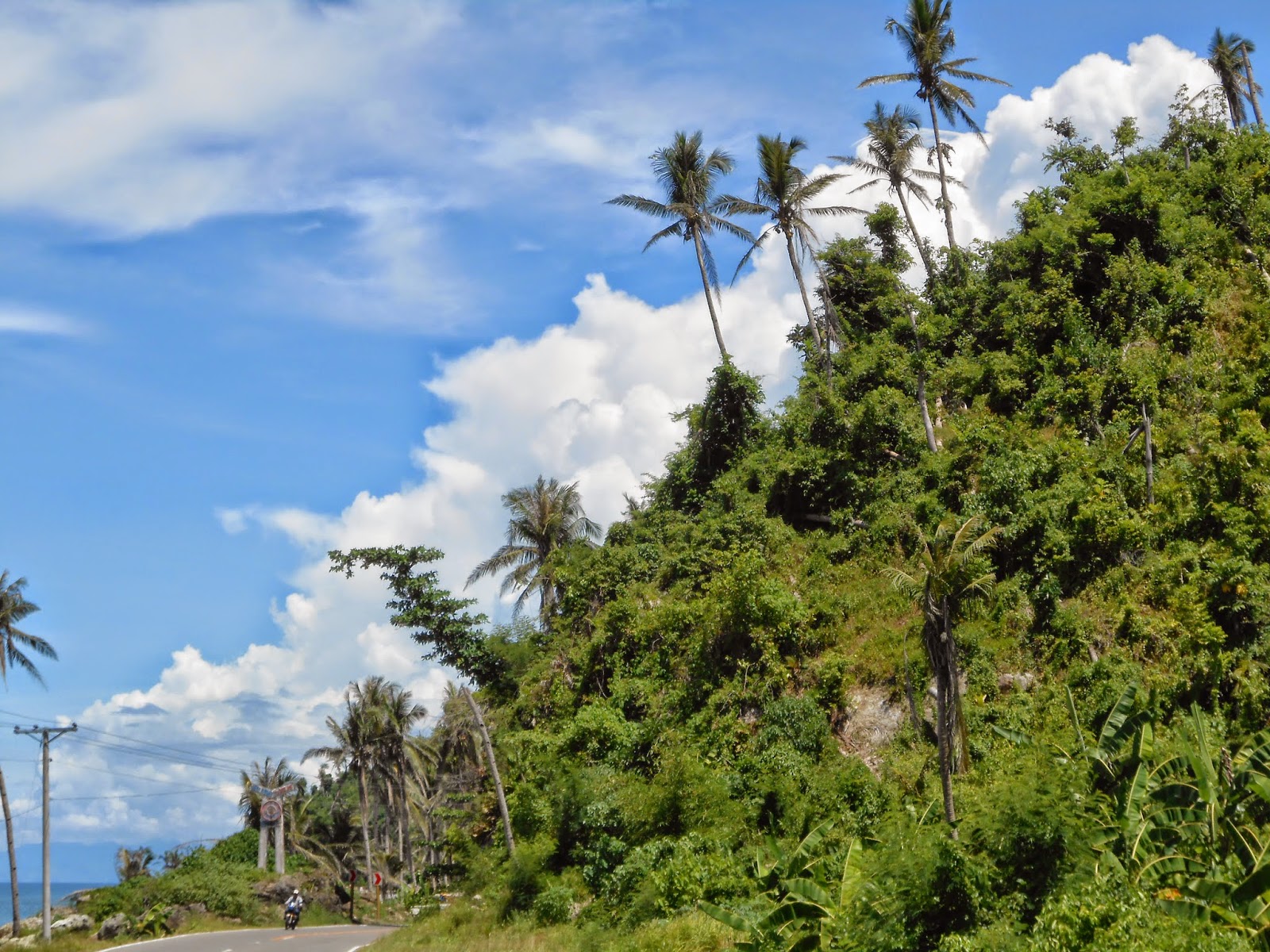 |
| Where the highway hugs the sea and hills in, between Tolosa and Dulag. |
 |
| Entering the earthship. |
 |
| Inside, looking at the rice storage area. |
Trevor
No comments:
Post a Comment